Viabundus Update 2.0 – Virtual Event

Friday, 25. April 2025, 10-12h CEST

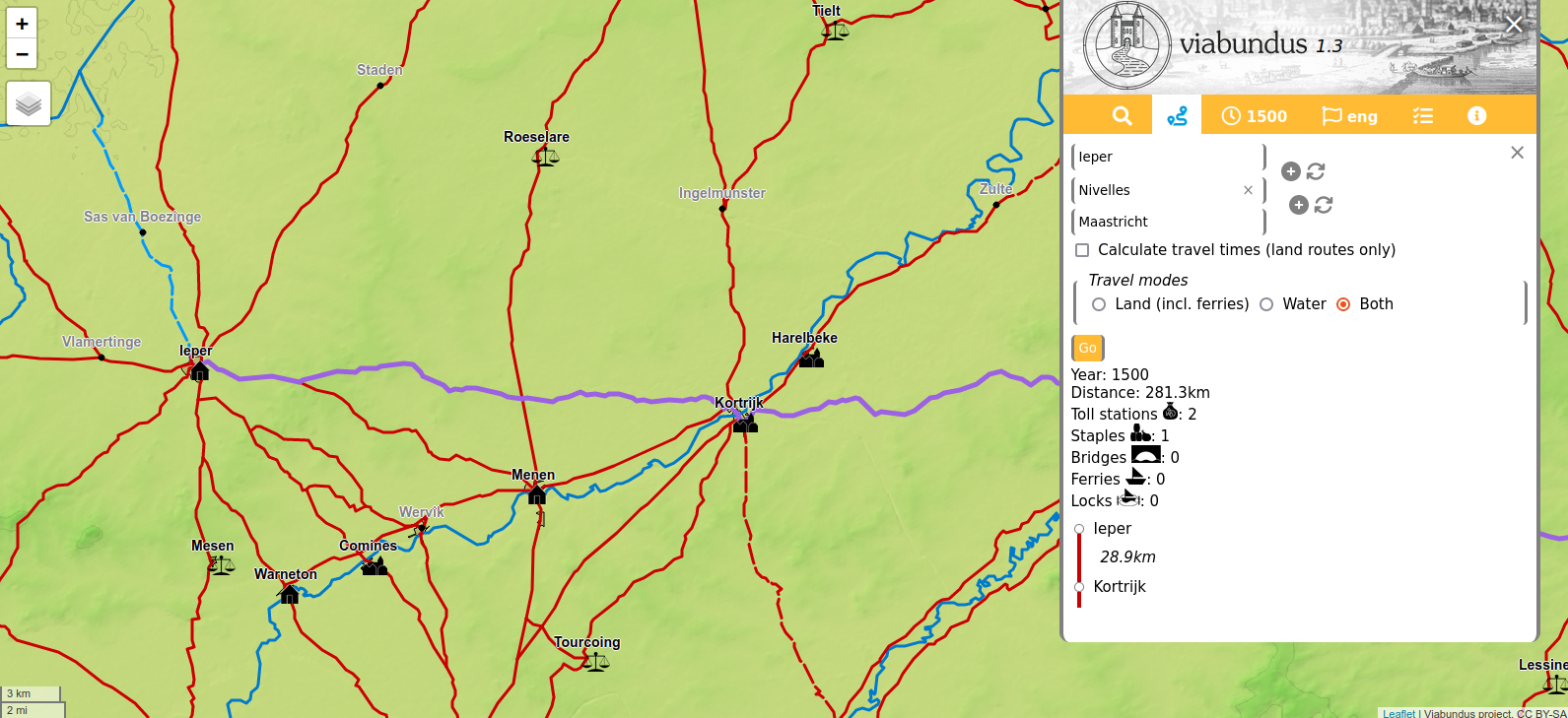
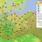
Viabundus celebrates the inclusion of of our partner Viabundus Finland‘s datset into the Viabundus map. Viabundus Finland 1350-1650 started as an independent subproject in 2022, funded by the Kone Foundation and led by Docent Tapio Salminen PhD from Tampere University. During three years of groundbreaking work, the Finnish team mapped historic roads, which crossed in an environment significantly different from the regions covered by Viabundus up to now. The Finnish dataset demanded some changes in the database itself, since medieval and early modern traffic in Finland was very seasonal, and different routes were used in summer and in winter. Think of frozen lakes opening up new roads or travelling on sledges through a forestry landscape. The seasonality of Nordic traffic evokes interesting questions about heavy transport and logistics, which can now be studied with the help of the database.

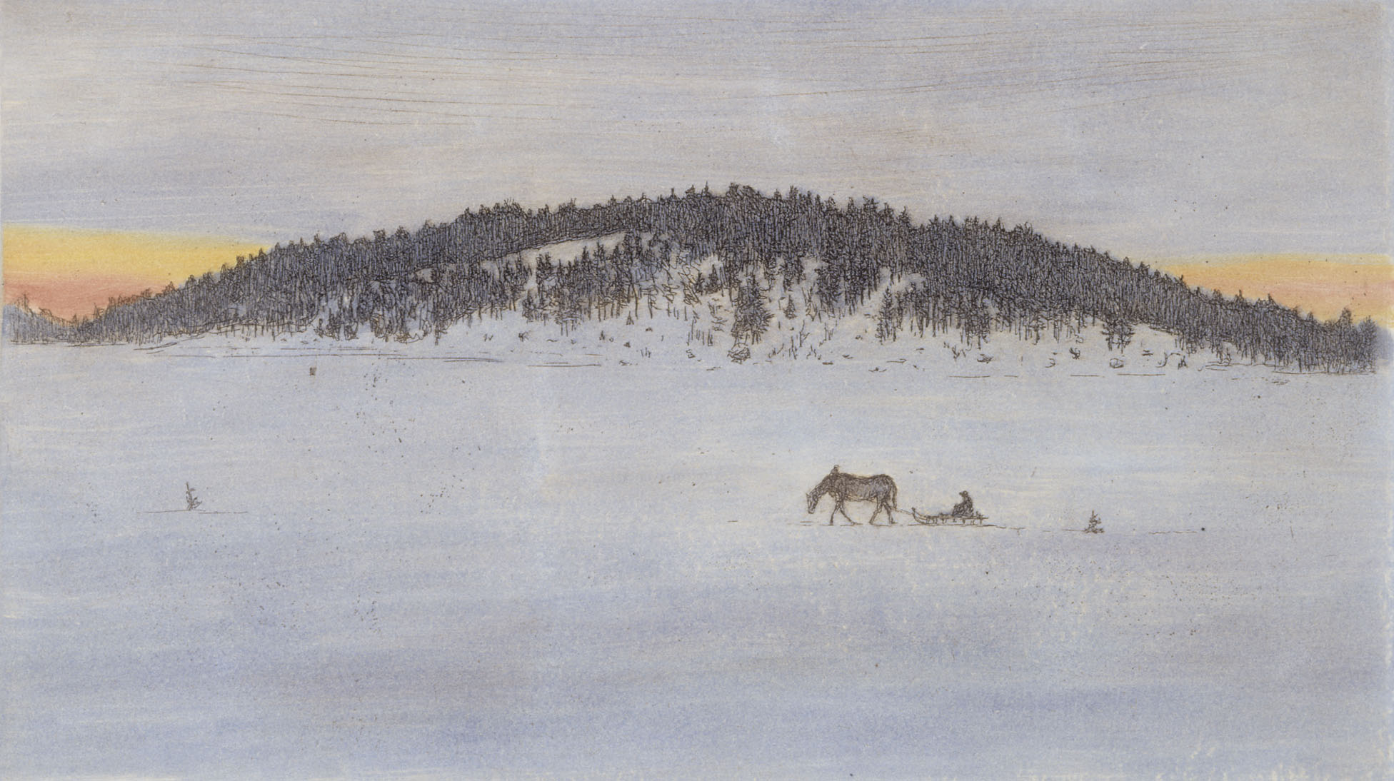
Hugo Simberg (1873-1917), Talvitie I, 1899

Join us for two hours packed with short presentations on the new features of Viabundus, the Finnish perspective and the Swedish data, that are currently in the making:

Time: Friday 25 April, 2025, 10.00–12.00 CEST (11.00–13.00 EET)

10:00 Opening (Niels Petersen)
> What’s new? Viabundus 2.0 updates (Bart Holterman)

10:30 Everything on the inclusion of the Finnish data
> Overview on the Viabundus Finland project (Tapio Salminen)
> Roads (Katrina Virtanen)
> Inns (Jenni Lares)
> Fairs, towns and other nodes (Tapio Salminen)

11:30 Outlook and Q&A
> The new Viabundus Sweden project (Johan Åhlfeldt)
> Q&A, Volunteers, Use Cases, Support, collaborations

12:00 End

Place: Zoom, register here for the link no later than Wed 23 Apr
https://forms.office.com/e/272Rb33dR8

Itiner-e and Viabundus Workshop on Historical Road Networks in Aarhus, 24-25 October 2024

A couple of weeks ago, a workshop took place in Aarhus, Denmark to celebrate the launch of the Itiner-e dataset of roads in the Roman Empire. The dataset and website were created by a team led by Tom Brughmans, Pau de Soto Cañamares and Adam Pažout, and can be found here: itiner-e.org

The team of Viabundus Denmark, also located in Aarhus, cooperates with the developers of Itiner-e, as both projects are concerned with similar topics (digitalizing historical road networks) and therefore face similar problems. Especially how to keep a collaborative digital project alive, how to correct and extend the data, and how to maintain a web platform after the initial project funding has ended, are questions which concern many digital datasets, and the Itiner-e and Viabundus projects in particular. For this reason, the workshop invited a group of archaeologists and historians as well as other scholars specialized in all premodern time periods, from various institutes in Europe and the USA, to discuss what digital resources about historical roads should ideally look like, and to explore possibilities of collaboration and the maintenance of a community of interested scholars and students.

Photograph of the participants of the Itiner-e and Viabundus workshop on the roof of Moesgaard Museum The participants of the Itiner-e and Viabundus workshop on the roof of Moesgaard Museum.

Read more

Waterways in Viabundus, part 1: natural waterways

Bart Holterman

Much has been written already about premodern roads on this blog. However, the Viabundus dataset also contains a second important mode of transportation: inland waterways. This series of blogposts will shed a light on the peculiarities of transport over water in premodern times, and focus on the human interventions in the waterways in the form of dams, locks and canal construction. This first part is concerned with natural waterways.


View of Hann. Münden by Franz Hogenberg (1584). The town was an important staple market, where commodities were transshipped between vessels sailing on the Weser, Fulda and Werra rivers.

Read more

Viabundus Update 1.1 (St Nicholas)

Ever since the release of Viabundus 1.0 in April this year, the team has worked hard on extending, editing and correcting the Viabundus dataset. The results of this work were released to the public on St Nicholas’ Day, December 6th.

The most important addition to the dataset is the inclusion of the premodern road system in Denmark, which was celebrated with a hybrid workshop in Aarhus on December 8th. With the addition of the Danish roads, it is now possible to travel digitally as far as the region of Skåne in modern-day Sweden. Credits for the dataset go out to the Danish team Kasper Andersen, Peter Jensen, Casper Skaaning Andersen, Simon Harritz and Emma Klos. Behind the scenes, additional data will be entered about the nodes in Denmark, which will be released in Spring next year.

St Nicholas saves a ship in a storm (Agnolo Gaddi, ca. 1393-1396)

Read more

Viabundus-Edges in QGIS

Kurzworkshop Viabundus und QGIS (auf deutsch)

Viabundus ist in erster Linie eine digitale Karte vormoderner Verkehrswege. Zugleich stecken darin aber noch viel mehr Daten und damit Möglichkeiten, diesen Fundus für eigene Forschungen nutzbar zu machen. Wir möchten in einem gut zweieinhalbstündigen Workshop zeigen, wie man die Viabundus-Daten in der kostenfreien Software QGIS darstellen, anpassen und kombinieren kann.
Der Workshop richtet sich an Interessierte ohne oder mit geringen Vorkenntnissen in GIS. Es werden die Grundzüge des Programms und die Konstruktion räumlicher Daten am konkreten Beispiel erklärt. Der Schwerpunkt liegt auf der Vermittlung des Grundverständnisses von Viabundus-Daten und QGIS-Anwendung. Wer Lust hat, kann dies parallel am eigenen Rechner anhand des vorab bereitgestellten und in der Vorstellung verwendeten Viabundus-Datensatzes nachvollziehen. Es sind hierfür interaktive Phasen vorgesehen. Zugleich funktioniert der Workshop als reine Demonstration. Anhand der Unterlagen ist es möglich, die Schritte später individuell nachzuvollziehen.
Ziel der Veranstaltung ist es, Interessierten einen Einstieg in GIS zu geben und es ihnen zu ermöglichen, einfache Projekte selbst umzusetzen.

Der Workshop findet online via Big Blue Button (über Browser, keine Installation nötig) am Mo., 13.09.21, um 15:30 Uhr statt. Sprache ist deutsch, die Teilnahme ist kostenlos. Anmeldung bitte bis zum 09.08.21 an workshop@viabundus.eu. Angemeldete erhalten Details zur Softwareinstallation und weitere Unterlagen.

Stanley Donwood, Holloway

Include the Artists!

by Niels Petersen, Team Göttingen

When bookstores reopened in Germany after the first anti-pandemic measures, it was the cover of a German translation of Robert Macfarlane’s “Holloway” (“Hohlweg” in German) that caught my eye in the display (it might have to do something with a biased view…). The Artist Stanley Donwood created an image of branches of a multitude of trees, intricately woven around a path. They constitute some sort of tunnel that almost sucks you into the small book.

Read more

Viabundus @ Coding da Vinci

Viabundus @ Coding da Vinci

“Coding da Vinci is the German hackathon for open cultural data. Since 2014 it brings together technophile communities, cultural enthusiasts and institutions of cultural heritage in Germany in order to further unfold the creative potential in our digital cultural heritage.”

What a great idea, we thought, and so we provide our data for the current hackathon #CdVSH2021 that runs from April 24 to June 11 2021. What will a creative mind do with pre-modern roads? Make a game or app out of them? Combine them with one or more of the 54 datasets archives, museums and libraries in Schleswig-Holstein provide?
We are excited, keep exploring!


The presentation of our data.

Here we go: Publication of Viabundus 1.0 on April 19th

Here we go: Publication of Viabundus 1.0 on April 19th

Just as books are read one word at a time, roads are taken one step at a time.
Xuē Xīnrán 薛欣然

Almost four years after the initial idea we want to celebrate with you our first steps on the road and are proud to present where they led us: the publication of Viabundus 1.0

Join us for the roughly 90-minute presentation of the map and database and see for yourself what we made out of our journey so far. We’ll show you how the map and data look like and how you can use them for your research. On Monday, April 19th, 16:00 CEST, via Zoom. Register to get the login here: launch@viabundus.eu

The map will be published on www.viabundus.eu, the blog will move to blog.viabundus.eu

There is a time when ideas seem to be ripe, for that is what we experienced. From the time on when we started the project we came across quite a lot of similar projects around Europe and the US. While ORBIS already existed, viator-e of Spain is quickly making progress. The Historical Atlas of Poland very recently came to an end, while Viae Regiae is developing at a breath-taking pace. Mapping early France will start soon at St. Andrews, and the World Historical Gazetteer published its first version.

Our aim was to map the trade routes of Northern Europe for the time between 1350 and 1650, where hanseatic merchants were active. The atlas Die Hansischen Handelsstraßen (1963-1968) in the scale of 1:500.000 gave us a scientifically sound and source-based foundation for a first road network. Funding enabled us to get a much higher precision in northern Germany and Denmark and helped volunteers to enter data for the Netherlands. Partners in Finland, Poland and the United Kingdom still offer their help and data. The gazetteer of places along the roads and rivers comprises more than 10.000 entries on settlements, fairs, staples and customs and several elements more.

While applying for a grant we once told the board in an interview: “Well, sure not everything is clear at this stage, but someone has to start and things will find their place”. Unsurprisingly this didn’t convince them then, but the application was successful, nevertheless. It was – and still is – a huge learning process for all in the ever-growing team of researchers with backgrounds in archaeology, history and Geography. Historians had to develop databases, Geographers had to learn about the pitfalls of historical tradition, all had to learn about historical geography. For that reason, the map cannot be “complete” if ever this could apply to a digital map. There is a lot to do to make the platform more open for data exchange and connection, the technology more sound, the content richer. We want to apply all the tools out there. But then, “roads are to be taken step by step” and we will to travel further along that road.

Three babies were born during the project, three weddings and a Ph.D. have been celebrated. But we also mourn the loss of the author of the original atlas, Hugo Weczerka, who died at the age of 91 on March 31st 2021.