What did medieval roads look like?

What did medieval roads look like?

by Nina Dengg, Team Magdeburg

While there has been much writing about travel on roads here at Viabundus, we still haven’t addressed the question of what medieval land roads actually looked like.
In contrast to the road system in medieval cities, where we already have early evidence for paved roads, the medieval country road system was known for its bad condition (if anything is known about it at all). This is certainly due to the fact that, among other things, in most cases they were unpaved, and were therefore prone to change. The circumstance that prominent medieval writers such as Gregory of Tours tend to complain about the bad condition of the roads rather than praise them may have done the rest.
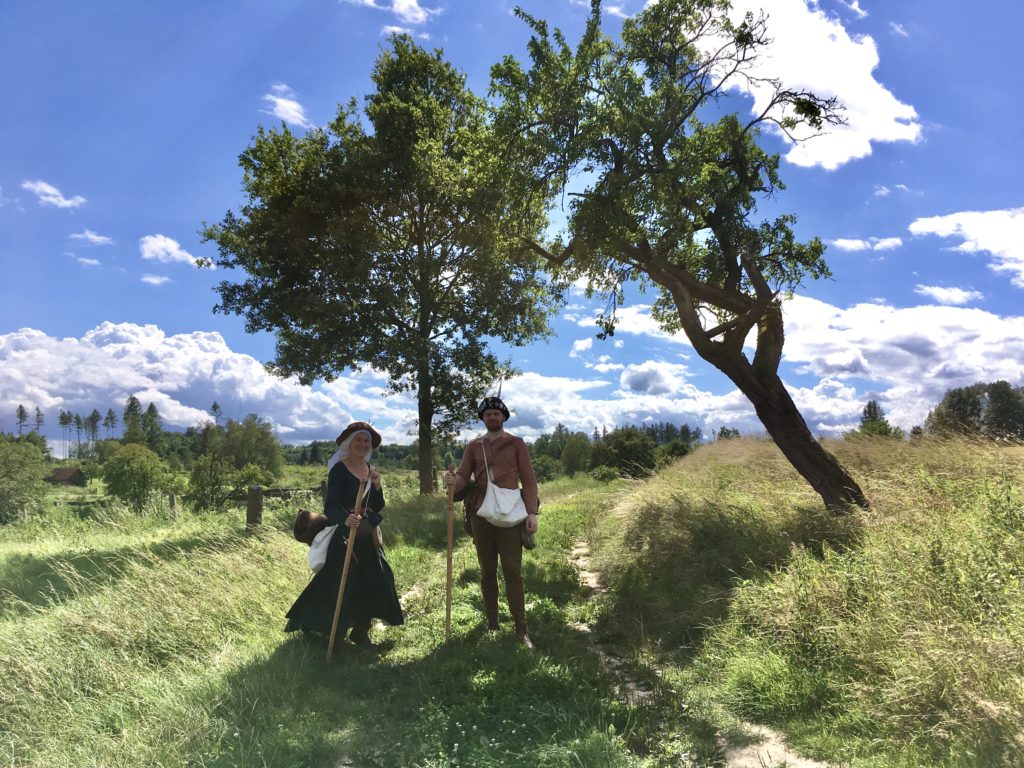
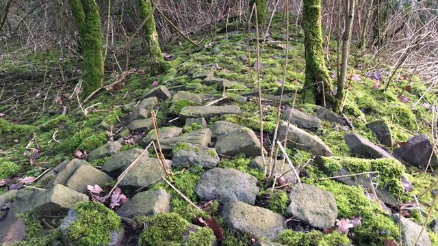
However, the appearance of the roads was highly variable: it depended on the travelers, the type of use, the weather conditions and the seasonal climate. Because of the flexible nature of the paths, in some places the roads fanned up into wide path bundles, which are characterized by several parallel routes in the terrain and also influenced the location of land use and territorial boundaries. Generally, we can at least state that in areas with greater landscape relief and steep slopes, high valley shoulders or terraced edges were chosen to move on, in order to avoid mountainous areas. In most cases, paving the road only became necessary as soon it was used by vehicles that were not suited for using the bare subsoil. For this reason, roads can usually only be attested archaeologically when they were designed for carts or wagons.
In the following, I will show some typical road types that have been uncovered by archaeological finds. Most of them were in use during the Middle Ages throughout Europe and left traces in the terrain until today. However, it must be noted that most archaeological finds of road constructions cannot be dated and thus not all types of roads can clearly be placed into the Middle Ages. Moreover, several road construction techniques were used until Early Modern times or even longer, so remains of old road construction do not necessarily point to ancient or medieval roads.

Read more

The Schenkenschans situated between the Waal and the Rhine on a map with the situation around 1635 made by J.J. Schot, 1649, Atlas van Loon.

Toll Stations along the great Rivers

by Leendert van Prooije, Team Netherlands

A toll levied on shipping traffic on a river is a good indicator of an important trade route. A lord or government had an interest in maximizing the revenue from the toll on the transport of goods. The place for such a toll was therefore logically on a heavily used trade route.
The owner of a toll employed staff to collect the toll or leased the task of collecting. In both cases, a written registration was important. It provided a means of verification to determine whether the revenues paid corresponded with the shipping traffic that had been passing. And to us historians or anyone else interested in trade and transportation today, the registration kept on tolls are a rich treasure trove of information on the details of trade. Who transported when, how much of what, for which owner, from where to where, with which ship type and how much had to be paid? These are just about the questions that can be answered with a toll register. And if you have toll registers available over a long series of years, you can beautifully portray the developments in shipping traffic and in trade flows.

A fascinating resource these toll records.

Read more

Road Testing with Living History

Non est ad astra mollis e terris via

Seneca wrote, and he sure knew what he was talking about. There is no gentle and earthly way to the stars. It doesn’t have to be the stars, though. A saint would do.
The two historians Mai-Britt and Philipp, who have some really nice living history projects running unter the flag of Histo|Faber, found a charter that mentioned a pilgrim from Hildesheim who had been robbed on his way to Nikolausberg near Göttingen in the year 1401. That pilgrim travelled in late January while Mai-Britt and Philipp opted for late August.
In historical accurate dress and attire, especially in specially manufactured leather shoes they made the 100 km (62 miles) in three days. Some of the Göttingen team joined them for the last 18 km. Niels could ask a few questions about wayfinding, the role of the viabundus-map to which we granted them a special access, and how to interpret the experience in terms of historical insight.

historfaber under a tree

Read more

The “Dark Ages” of the Roman Roads

By Nina Dengg, Team Magdeburg

The Viabundus project initially aims to map the Hanseatic road system. It stretched from the Netherlands all the way to Russia and from Denmark to Czechia. One can rightly say that a truly European road system was established and used, not to mention the connections that existed via sea routes.

But this is only the perspective of the Hanse: Pan-European road systems are much older and have connected Europe since Antiquity. The most famous example would be the imperial road system that the Romans maintained, which stretched from the westernmost tips of Europe, along the Mediterranean, including the North African colonies all the way to the Levante during its Golden Age. The clearly organised structure of the Roman road network has attracted much attention from researchers, resulting among others in the ORBIS digital map of Roman roads, which has been an important source of inspiration for the Viabundus project.

But what happened to this expansive road system? How come we can see the remains of Roman roads quite clearly until today in certain places, while in others they seem to have disappeared completely? The following thoughts are derived from my master’s thesis in which I worked on the (dis)continuity of the Roman road network in northern Italy, the Alps and southern Germany.

The Roman road system. Map by Furfur (German localization (with minor changes) of the original by Andrei Nacu) – Wikimedia Commons.

Read more

Disease control and pre-modern travelling

By Bart Holterman

During the current pandemic, it has become clear that viruses are spread all the more quickly by human movement. Among the first measures taken to stop the spread of the Corona virus were travel restrictions, eventually resulting in the lockdown of entire countries. Interestingly, the reaction of governments to epidemics has many parallels in pre-modern times. Despite the modern advances in medical knowledge, the basic factors are still the same: human contact, especially combined with frequent long-distance travel connections, significantly stimulates the spread of diseases. Although pre-modern authorities did not understand the mechanisms behind infections well, it was clear that social distancing and travel restrictions greatly reduced the chance that diseases would spread. Not for nothing the term quarantaine is derived from a medieval measure first taken in Venice during the Black Death, where merchant ships arriving to the city that were suspected of being plague-infected would have to wait 40 days (Italian: quaranta giorni) in isolation before being allowed to enter the city.

Death as a cart driver. Detail from Pieter Bruegel the Elder, The Triumph of Death (c. 1562).

Read more

Inns: tiny but indispensable

By Maartje A.B. (Radboud University; Viabundus Team The Netherlands)

The nodes on our Viabundus map come in all shapes and sizes. Among the tiny ones are inns. They could be a single house in the middle of nowhere, and yet function as crucial elements in our road system. The presence of an inn along a road could determine whether it was still possible to continue the journey, even though the next town could not be reached before darkness, and thus influence travel time. However, the exact location and the history of inns are often hard to identify, and therefore we cannot claim to present a complete set at the end of the project. The end result we aim for will rather be a solid basis for further research, in which especially inns laying outside towns between 1350 and 1650 are incorporated as much as currently possible.

In April, I wrote a blog post about inns on the Dutch blog of my dissertation project ‘Mirror of mutual relations: communication between Hanseatic cities (ca 1450-1650)’, with examples related to the area central to this research: the region around the rivers Rhine, Meuse, Waal and IJssel. On my project blog, I share research results, interesting finds, and project-related activities. What follows is a translation of this blog post, showing why inns are fascinating places worth bearing in mind in different types of historical research.

A typical inn in a village, according to J.W. van Petersen, because of the sign and trough (ca 1800, anonymus) in: Reizen is tol betalen, p. 123.
Read more

The backbone of Viabundus: the nodes database

In this post (in German), Nathalie Rudolph of the FGHO in Lübeck gives us an insight into her work on the backbone of the Viabundus map: the database with nodes.

Hinter den Kulissen: (M)ein Tag mit der Datenbank
Ein Werkstattbericht von Nathalie Rudolph (FGHO).
Das Viabundus Projekt hat sich zum Ziel gesetzt, eine online frei zugänglichen digitalen Karte von vormodernen Fernstraßen in Nordeuropa zu schaffen. Die Idee für diese Karte entstand 2017 in einer Tagungs-Kaffeepause. Mit dem erfolgreichen Pro*Niedersachsen-Antrag konnte es dann in Zusammenarbeit von IHLF (Uni Göttingen) und FGHO (Lübeck) mit einem Projekt zum Gebiet des heutigen Niedersachsen losgehen.
Für eine solche Karte braucht man jedoch eine Datengrundlage, in dem Fall Viabundus eine Datenbank mit „Nodes“ (Knoten), wozu wir von der FGHO in Lübeck die Vorarbeit geleistet haben. Wir von der Ausgangspunkt war die Arbeit mit dem Buch „Hansische Handelsstraßen“ von Friedrich Bruns und Hugo Weczerka von 1962, aus dem Friederike Holst, meine Vorgängerin, die „Nodes“ herausgesucht hat. Bei den „Nodes“ handelt es sich um Orte, aber auch beispielsweise um Häfen, Zölle und Jahrmärkte, die Land- oder Wasserstraßen verbinden. Seit der „Kaffeepause“ sind heute bereits 11.000 Orte in der Datenbank verzeichnet.
Read more

Viabundus – der Straße folgen(d) / following the road

For English see below

Welchen Namen gibt man einem Projekt, das sich mit mittelalterlichen Handelsrouten und -straßen in (Nord-)Europa beschäftigt und diese in Form einer Karte in einem Geographischen Informationssystem (GIS) digitalisieren möchte? Es wurde schnell klar, dass der frühere Name, „Vormoderne Fernhandelsstraßen und regionales Wegenetz in Norddeutschland“, keine Option darstellte, da unter diesem Titel nicht alle Aspekte und derzeitige sowie zukünftige Partner des Projekts einbezogen werden.
Unter Rücksichtnahme sämtlicher Anforderungen an den Titel wurden zunächst einige Akronyme entwickelt: PRISM („premodern roads interactive street map“), NERTS („Northern European road and transport systems“) oder DRONE („Digital roads of Northern Europe“). Allerdings waren die Akronyme nicht zufriedenstellend und gleichzeitig wurde unter keinem Titel das Projekt auf den Punkt gebracht. Daher griffen wir zum ‘Allheilmittel der Historiker’: Latein! So wurde schnell entschieden, dass Viabundus – frei übersetzt als „der Straße folgen(d)“ oder „weitergehen(d)“ – gut zusammenfasst, was Gegenstand unseres Projekts ist. Ergänzt um den Untertitel „Map of premodern European transport and mobility“ („Karte des vormodernen, europäischen Transports und der Mobilität“) sind wir zuversichtlich, dass ein Name gefunden wurde, der zugleich einprägsam und verständlich ist.
Read more

After the first year: a look behind the scenes

It has now been one year since our pilot project about Lower Saxony started in Göttingen. Moreover, the project partners in Aarhus and Magdeburg are in the saddle and the Dutch project is taking on shape. Time for our second plenary meeting to discuss the state of the project, this time at the offices of our team at Otto von Guericke Universität in Magdeburg on January 23 and 24.

Confidential Documents on the Table
Two days of technical details and strategic discussions at our Magdeburg Workshop

Read more

Medieval road discovered in Flanders

VRT News: Middeleeuwse "snelweg" ontdekt
Middeleeuwse “snelweg” Gavere bij toeval ontdekt

In April this year, volunteers of the local tourist organization in Gavere near Gent, Flanders, discovered the overgrown remains of a late medieval paved road near the village of Asper by chance. They were planning a historical walking tour and saw that on old maps (1669) a road was drawn which did not exist anymore. Visiting the site, they discovered the setts (stones) of the former road under the earth and bushes.
Most pre-modern road remnants take the form of hollow roads, where the road lies deeper than the surrounding land, carved out from the earth’s surface by centuries of continuous use (see for example the image in the blog’s header). The find of the Flanders road is exceptional in that it is the opposite of a hollow road: the paved road surface is located on a higher level than the surrounding land. Roads like these were constructed in terrain that was marshy or prone to flooding, designed to prevent the road from turning into a mud pool.
The map that is being created by the pre-modern streetmap project is also intended to cover a part of Flanders. If we will find someone to work on a Flemish sub-project (volunteers welcome!), the newly discovered road might be included on the map as well. At least the find shows us that when trying to reconstruct medieval roads, it is sometimes worth going into the field in addition to studying old maps and written sources.
Original article (in Dutch) here: https://www.vrt.be/vrtnws/nl/2019/04/24/middeleeuwse-snelweg-gavere-bij-toeval-ontdekt/